ONEO
Programme Reference
GT21?076ES
Status
Closed
Country
Spain
Start Date
2021
End Date
2022
Programme: GSTP Prime Contractor: INDRA SISTEMAS
Objectives
Objectives
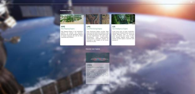
To develop a package of EO-services (4) to be embedded in Indra platform OnEO for government agencies to capitalize available satellite information
To apply AI techniques in fields where the use of these techniques are not widespread and hence differential
To develop services so they can be easily tailored for the specific needs of the users
Description
Background and justification:
Government agencies in developing countries sometimes do not take advantage of their own investments in satellites and the Copernicus data flow
Illicit activities are usually located in remote areas with limited possibilities of ground-monitoring; country-wide land use change monitoring and frequent or even continuous monitoring of assets potentially affected by hazards can efficiently be tackled with satellite information
OnEO is a tool for governments to take decisions in three different topics with the help of EO-based geospatial services
Achievements and status:
Key users have been identified and have participated in the definition of high level requirements, improving OnEO’s market penetration
Potential market has been re-analyzed and there are at least six customers potentially interested
All low level requirements are already defined
The four EO-based services have been already designed and prototyped for ensuring performance required by users
Deep learning models have been prototyped and proved for ensuring success in the development phase
Benefits:
Illicit crop awareness will help users to prioritize field-based or drone campaigns thanks to the identification on zones prone to having illicit crops; illegal mining monitoring to identify new open pit mining or assess their environmental impact; land use change monitoring will provide bespoke land use country wide assessments in a short time period; and critical assets monitoring aims to support the management of assets against wildfires
• Application domain: Earth Observation
•
Technology Domain:
OTHERS
OTHERS
•
Competence Domain:
8-Ground Systems and Mission Operations
8-Ground Systems and Mission Operations
• Initial TRL: TRL N/A
• Target TRL: TRL N/A
•HarmoRoadMap: N/A
•IPC Document: N/A