ESA real time Ionospheric Continental Caster for high precision applications
Programme Reference
T607-601EF
Status
Closed
Country
Spain
Start Date
2019
End Date
2023
Programme: TDE Prime Contractor: UNIV POLITEC DE CATALUNYA
Objectives
To develop a prototype tool for Real-Time 3D ionosphere corrections tailored to high precision navigation applications. To explore new ionosphere messages, needs of ground infrastructure and computing strategies for future algorithms
Description
GNSS users seek better position estimates; this means high precision and shorter times to achieve low error positions. In addition, the number of GNSS receivers, both single or multi-frequency and/or multi-constellation are growing and an increasing number of applications and services rely on these estimates. In this framework, the development of the Fast Precise Point Position and similar algorithms seem to cover the need for faster (low convergence time) and more precise position estimates in Real-Time (RT). The key feature of this technology is the distribution of precise information to the user. Among this information are the ionospheric corrections, which need to be precise and well bounded, to be able to add information on the positioning calculation. However, at the present there is not a clear model and message to be sent to the user
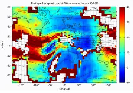
ESA real time Inospheric Continental Caster (e-RTICC) enables high accuracy navigation especially in regions where there are high ionospheric gradients, for single and multi-frequency -mostly Dual-Frequency- users. It could lead to reduction of ground segment cost. This activity focuses on the implementation of a 3D High Precision Ionospheric correction RT caster tool; that allows assessing different RT computation strategies for various geographic locations, network sizes and different ionospheric messages to achieve high accuracy ionospheric estimates.
This activity encompasses the following tasks:
- Study of RT high precision 3D ionosphere models. Including trade-off of temporal sampling and geographical information regarding the message structure vs. Precision, computation load, need for interpolation. Selection of the most suitable candidate to be implemented in RT.
- Selection and development of suitable algorithms to perform RT Ambiguity fixing for ionospheric computation with at least GPS and Galileo.
- Selection and development of RT ionospheric messages for High Accuracy estimation, accounting for terrestrial broadcast (i.e. 5G) or GEO/MEO satellites.
- Design of a modular e-RTICC, in order to allow the maintenance and expandability of the tool. In general terms should be: data stream input, pre-processing of data, ambiguity fixing, ionosphere correction calculation, interpolation (if needed), message generation, message broadcasting.
- Implementation of the e-RTICC.
- RT campaigns. Study of the e-RTICC accuracy in the position domain with respect to network size and user location. Study for Mid-Latitudes (Europe) and Low-Latitudes (South America). Recommendations over those regions.
• Application domain: Navigation
•
Technology Domain:
7 - Electromagnetic Technologies and Techniques
7 - Electromagnetic Technologies and Techniques
•
Competence Domain:
9-Digital Engineering
9-Digital Engineering
• Initial TRL: TRL 2
• Target TRL: TRL 3
•HarmoRoadMap: N/A
•IPC Document: ESA/IPC(2019)3
•Public Document: