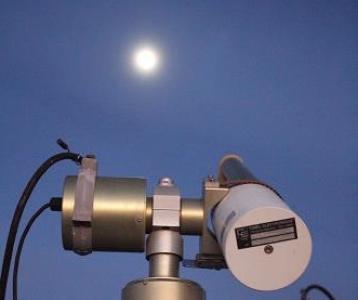
Lunar spectral irradiance measurement and modelling for absolute calibration of EO optical sensors

Earth observation by satellites provides essential datasets for a wide range of commercial, societal and scientific applications. Satellites have been observing the state of the environment since the launch of the radiation balance instrument on Explorer 8 in October 1959, and over the last 60 years the range of observation types and applications has grown exponentially. Today operational long-term sustained Earth observation programmes, exemplified by the Copernicus Sentinels, give a wide range of users reliable environmental information services. These EO data will also provide a legacy of information about environmental and climate change for future generations seeking to manage their collective existence on Earth.
To meet the interoperability demands of today’s applications, which combine data from different sensors, and to meet the long-term stability requirements of climate change analyses that must observe small trends on top of large natural variability, satellite datasets must be stable, harmonised, and have associated with them reliable and robust evaluations of their uncertainty. Recognising this, the Committee on Earth Observation Satellites (CEOS) agreed a 'Quality Assurance Framework for Earth Observation' (QA4EO; www.qa4eo.org) in 2010, which set guidelines for establishing and providing quality indicators for satellite sensor data records.
Vicarious calibration and comparison methods, which use observations of reference sites to monitor the stability and/or absolute performance of satellite instruments, as well as to determine inter-sensor biases, have long been used to evaluate the performance of Earth observation sensors. These references include natural phenomena (e.g. Rayleigh scattering over dark ocean sites, sun-glint reflected from water, deep convective clouds which provide a 'white' reference for inter-band calibration), pseudo-invariant calibration sites (PICS), such as those in deserts or ice sheets that are sufficiently stable over time for non-simultaneous sensor inter-comparisons and for long-term stability monitoring, and instrumented sites such as the radiometric calibration network RadCalNet.
One important vicarious reference source is the Moon. With no atmosphere, the Moon is extremely stable long term. Geostationary satellite instruments sometimes observe the Moon in the 'dark space corners' of an image and low-Earth orbit sensors can be manoeuvred to observe the Moon. Many satellites already use the Moon as a calibration source, particularly to monitor long term stability. The Moon also has a similar reflectance to the earth, and so calibrates sensors at the correct level (unlike, say, very bright targets such as clouds and onboard calibration references).
However, to use the Moon as a reference, it is necessary to model its phase and libration changes. There are many periodic cycles that apply to the Moon, Earth and Sun geometry. The cycle with the longest period is called the Saros cycle and its duration is 223 synodic months, which is 18 years, 11 days and 8 hours. After this cycle, Earth, Moon and Sun return to the same relative geometry. The shortest cycle is the variation in phase angle which takes about 28 days between two full moons. The cycle for the distance between Sun and Earth/Moon takes about one year.
Current lunar observations are corrected for this cycle using the ROLO model, or the GSICS implementation of the ROLO model (GIRO). The ROLO (RObotic Lunar Observatory) model is based on observations made between March 1996 and September 2003 by Kieffer and Stone.
This project aimed to determine an improved model based on the same equation, but with new lunar observations, and to compare this improved model with the original ROLO/GIRO model and with satellite observations of the Moon.
