InSAR based tarrain motion mapping in support of landslide hazard assessment in high mountain areas
Programme Reference
AO5-f
Country
Switzerland
Start Date
2016
End Date
2016
Programme: Discovery Prime Contractor: ETH ZÜRICH
Description
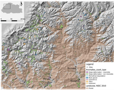
Results of this pilot project provide new hints on landslide occurrence in high alpine environments, and shows the enormous potential of satellite-based techniques to map, classify and explore large bedrock instabilities that represent significant hazards throughout remote regions. Moreover, our findings are extremely important especially for developing countries as Bhutan, where systematic acquisition and exploitation of EO data can allow for a better evaluation of landslide hazard at relatively low costs.
• Application domain: Generic Technologies
• Initial TRL: TRL N/A
• Target TRL: TRL N/A
•Public Document: